图书简介
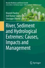
This edited book provides a platform for knowledge sharing in all areas related to the rivers, sediment and hydrological extremes. It explains the hypothesis that river flow and sediment transport are intimately linked to erosion, scour and sediment deposition. Sediment transport, erosion and deposition are driven by local base-level changes and are highly variable in space and time. These concepts have serious implication for understanding the recent development of the River, Sediment and Hydrological Extremes.The natural hazards posed by hydrologic events and river systems depend on the uncertainty of hydrological events. This ability is affected by change in climatic conditions. Climate change studies have revealed that the frequency of extreme weather phenomena with increasing damage to human assets has gradually grown worldwide. As a consequence, rainfall events concentrated in time and space are expected to lead to serious local flooding and sediment transport in many parts of the world. Floods are remarkable hydro-meteorological phenomena and forceful agents of geomorphic evolution in most physical geographical belts and, from the viewpoint of human society, among the most important environmental hazards. According to the Indian Environment Agency, floods rank as number one on the list of natural disasters in India over the past decade.This book is an attempt to fill the gap in literature and bring forth evidence based latest research about precise estimation of erosion and scour, which is essential to reduce the hazards. The book explains that lack of preparedness and appropriate adaptation strategy makes people more risk-prone. It highlights the vulnerability in South Asia region about the impacts of flood, sediments, and river hazards because a large portion of its population depends on sensitive sectors like agriculture and forestry for livelihoods and several other reasons.The book is relevant for academician, researchers and students of disaster management, hydrology and ecology.
Part 1. Introduction and Overview.- 1. Flood Modelling using MIF method with GIS techniques: a case study of Iril River catchment, Manipur, India.- 2. A case study on estimating the ecosystem service values (ESVS) under anthropogenic influences for Chennai and Hyderabad.- 3. Groundwater vulnerability mapping using modified drastic model: a GIS based case study of Imphal east district, Manipur, India.- 4. Flood hazard mapping using hydraulic models and GIS: a review.- 5. A case study on prediction of heatwave days using machine learning algorithms over Telangana.- 6. Quantifying the reliability of reanalysis precipitation products across India.- 7. Weakly nonlinear waves in non-ideal fluids.- 8. Spatial and temporal variability of soil moisture, its measurement and methods for analysis: a review.- Part 2. Causes and Impacts.- 9. Streamflow estimation using entropy-based flow routing technique in Brahmani river, Odisha.- 10. Infiltration of suspended fine sediments into surface layer of coarse sediment-bedded channel.- 11. River water flow prediction rate based on machine learning algorithms: a case study of Dez river, Iran.- 12. A case study in evaluating spatio-temporal variations in drought and its risk assessment over Telangana using satellite data.- 13. Drought modeling through drought indices in GIS environment: a case study of Thoubal district, Manipur, India.- 14. Copula based probabilistic evaluation of meteorological drought characteristics over India.- 15. Nonstationary flood frequency analysis: review of methods and models.- 16. Multi-day Extreme Precipitation Ranking and Association with Atmospheric Moisture Transport during Indian Summer Monsoon.- Part 3. River Restoration, Hydraulic Structure Stability and Flood Risk Management.- 17. Remote sensing and its application on soil and ecosystem services.- 18. Sustainable land and water management in urban areas: Emerging challenges.- 19. Nature of Bursting Events Over a Rigid Bed with Emergent Vegetation.- 20. Recirculation region control behind a partially submerged cylinder due to wave against current.- 21. Assessment of sedimentation in Kaliasote reservoir, Bhopal using satellite remote sensing techniques.- 22. Development of River Atlas using space and ground based inputs for Brahmaputra and Barak valleys in Assam, India.- 23. Numerical study of flow through Linear Weir.- 24. Artificial Intelligence Based Fully Scalable Realtime Early Flood Warning System.- 25. Sustainability through Integrated Resilience and Risk Management: Rivers and Disasters in Changing Climate.
Trade Policy 买家须知
- 关于产品:
- ● 正版保障:本网站隶属于中国国际图书贸易集团公司,确保所有图书都是100%正版。
- ● 环保纸张:进口图书大多使用的都是环保轻型张,颜色偏黄,重量比较轻。
- ● 毛边版:即书翻页的地方,故意做成了参差不齐的样子,一般为精装版,更具收藏价值。
关于退换货:
- 由于预订产品的特殊性,采购订单正式发订后,买方不得无故取消全部或部分产品的订购。
- 由于进口图书的特殊性,发生以下情况的,请直接拒收货物,由快递返回:
- ● 外包装破损/发错货/少发货/图书外观破损/图书配件不全(例如:光盘等)
并请在工作日通过电话400-008-1110联系我们。
- 签收后,如发生以下情况,请在签收后的5个工作日内联系客服办理退换货:
- ● 缺页/错页/错印/脱线
关于发货时间:
- 一般情况下:
- ●【现货】 下单后48小时内由北京(库房)发出快递。
- ●【预订】【预售】下单后国外发货,到货时间预计5-8周左右,店铺默认中通快递,如需顺丰快递邮费到付。
- ● 需要开具发票的客户,发货时间可能在上述基础上再延后1-2个工作日(紧急发票需求,请联系010-68433105/3213);
- ● 如遇其他特殊原因,对发货时间有影响的,我们会第一时间在网站公告,敬请留意。
关于到货时间:
- 由于进口图书入境入库后,都是委托第三方快递发货,所以我们只能保证在规定时间内发出,但无法为您保证确切的到货时间。
- ● 主要城市一般2-4天
- ● 偏远地区一般4-7天
关于接听咨询电话的时间:
- 010-68433105/3213正常接听咨询电话的时间为:周一至周五上午8:30~下午5:00,周六、日及法定节假日休息,将无法接听来电,敬请谅解。
- 其它时间您也可以通过邮件联系我们:customer@readgo.cn,工作日会优先处理。
关于快递:
- ● 已付款订单:主要由中通、宅急送负责派送,订单进度查询请拨打010-68433105/3213。
本书暂无推荐
本书暂无推荐